Cyclone Road 
CHASE BLOG
Cyclone Road |
CHASE BLOG |
|
Blog Front Main Chase Page All Chase Reports YouTube Site Feed  
Amos Magliocco's Storm Chase Blog
|
Thursday, April 30, 2009
Posted
12:14 PM
by Amos Magliocco
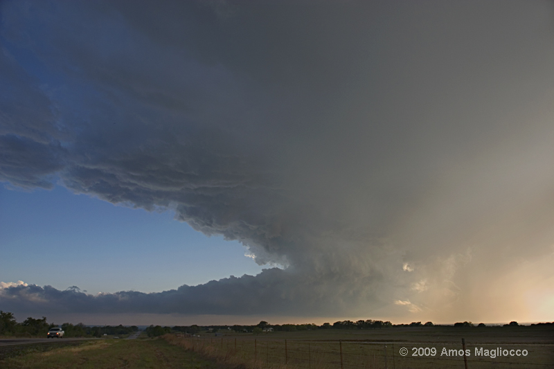
 the first storm we met around Eldorado, Oklahoma about 2300z  the second storm, with wall cloud, as it crossed the Red River Valley about 2328z  wallcloud tightens immediately before it collapsed 2328z Monday, April 27, 2009
Posted
7:03 PM
by Amos Magliocco
We left Woodward in the morning and stopped in Clinton, on Interstate 40. I assumed all the early rain and messy storms would wipe out northwest Oklahoma, but of course that would prove incorrect. From the interstate, waiting with Scott Currens, Scott Eubanks, Mike Peregrine, and Dave Fick, we analyzed the environment in southwest Oklahoma as highly supportive of tornadic supercells, with extreme instabilities, high helicities, and low LCLs. With the presence of a boundary and the dryline circulation for lift, it seemed as if a single storm moving into that airmass would have a great shot to produce a tornado. Meanwhile, the isolated storm down in North Texas, by Vernon, was cranking along around 14 knots, but refused to indicate any rotation or even generate a wall cloud report. The convection due west of us, in the eastern Texas panhandle and which later produced the beautiful tornado images everyone's seen by now, appeared multi-cellular and clustery, moving into more stable air (or so I thought). We spent a long time analyzing the relative vigor of the back-sheared anvil. In the end nobody argued in favor of chasing those cells. Then we took off for the isolated storm to the south. On the way, another cell fired southeast of Childress. This was west of the Vernon storm by sixty miles and I thought it would move into the same environment we'd admired for for an hour or more, plus there were no chasers on Spotter Network anywhere near it. It was a gamble, picking new convection over a well-established and isolated supercell, but I was hoping it would produce before a smaller audience. At Altus, Scott Eubanks and I turned west for this new storm. We met it near Eldorado, Oklahoma, followed it north as it produced marginal structure and a small wall cloud, then dropped it for the next one to the south. Seeding was a big problem in this group of storms, but the new cell had achieved some separation and I thought its updraft might have more time to do something. We emerged from a rain core to discover a massive wallcloud hovering over the Red River Valley. With sharp definition and a clear slot, the storm looked poised to drop a tornado at any moment. We moved closer until we reached the intersection of State Roads 6 and 34, as far south as we could go. Here, between Eldorado and Olustee, our wall cloud tightened, dipped, and...fell apart, never to be seen again. Splat. Soon the whole storm shriveled (while maintaining a nice hook shape on radar) and the base grew ragged and disorganized. We went home. A few pictures are in the post above this one. Sunday, April 26, 2009
Posted
12:02 AM
by Amos Magliocco
 a few miles north of Leedey, OK around 0030z Tuesday, April 21, 2009
Posted
8:32 AM
by Amos Magliocco
 Two years ago today, Eric Nguyen and I were hit by the tornado in Tulia, Texas. Despite only being a few minutes old, the tornado dragged Eric's SUV off the road and collapsed a brick building and a semi on the hood. Such a violent and terrifying experience is difficult to catalog with the language of everyday life. I suppose for those who've experienced a violent car accident, this was like the moment of impact if it lasted eight to ten seconds. Nothing about Tulia was exciting or fun. It was embarrassing, frightening, and destabilizing. We turned down three requests from Good Morning America over the next ten days because it was hard to talk about the incident even between the two of us. We couldn't imagine describing it to the world. It stripped away the necessary illusions of control that chasers take into the field. The flashbacks and second-guessng continued a long time, and I think time has made it more difficult to contend that Tulia did not play some small role in what happened to Eric a few months later. A few chasers, mainly those with pre-existing axes to grind, accused us of having played chicken with the tornado and lost. That's how important it was for them to cling to their idea that such a thing could never happen to experienced chasers in broad daylight. But it can. It did. Some good came from it. Eric's weather instruments, in which he took great pride, recorded unprecedented pressure data which Scott Blair and his co-authors forged into this paper in the Electronic Journal of Severe Storms Meteorology. I can't say what Tulia meant to Eric. Although by May and June we were talking about it a lot---almost every day---I know now there was much he did not share with me about his inner life. For me, one of the lighter moments of the experience was the distinct sensation I had during the tornado, along with many others, that I was about to die without having published a novel, and how stupid that was. I'm more committed than ever to remedying that, especially since it's late April and there's more tornadoes coming, and, despite everything, I'll still drive out to find them. Sunday, April 19, 2009
Posted
12:33 AM
by Amos Magliocco
Saturday, April 18, 2009
Posted
10:57 PM
by Amos Magliocco
 I spent a few hours trying to find a favorable shooting angle for this little rain shower. This was near Bridgeport, Texas around 7:00 pm. I met up with Scott Eubanks and Glenn Dixon for Italian food in Azle afterwards.
I wouldn't be surprised to see an isolated supercell on the DL in N TX later, around 0z, when the low level wind fields tighten.
Friday, April 03, 2009
Posted
6:06 PM
by Amos Magliocco
 "I'm streaming you streaming the streamers" In 2009 you can expect many more vehicles in and around storms than ever before. The VORTEX2 project will incorporate dozens of vehicles, mobile mesonets, DOWs, support vehicles and even, apparently, some kind of "media" bus--like an entourage, I guess. We'll have tour companies with their vans and production companies filming reality television shows, along with the dedicated entourages for those groups. Not to mention the added number of civilians who might swarm a warned storm for the chance to spot a familiar face. I've lost count of how many are dropping probes, launching predator drones, or remote control planes, trains, helicopters, and other vehicles. Streamers, stringers, strippers, and candy-stripers all will abound. The smallest population out on the roads this chase season will probably be the non-profit, non media-affiliated, independent chasers. And there's still quite a few of those left (I think). All this is to say that, if you're new, you might think about how all the cars will influence your decision-making process. I think it's dramatically safer to have a chase partner under these conditions, though it's certainly no guarantee something bad won't happen. Dr. Charles A. Doswell III has an essay about chasing safely and responsibly. Dr. Doswell is a 30 plus year chase veteran, one of the most important tornado scientists of the 20th century, whose research and contributions to forecasting and chasing are, in no small part, responsible for the forecasting and interception success of so many of us today--whether we're smart enough to know it or grateful enough to acknowledge it or not. This is an old document that is more relevant than ever for the sheer number of practical ideas and suggestions. It's worth reading. Storm Chasing with Safety, Courtesy, and Responsibility by Dr. Charles A. Doswell III
|